High Quality Imagery and Point Cloud Data Sets
Dominion Divers has the most advanced scanning and muti-beam sonar, as well as laser scanning and geo-referencing equipment and software to provide a complete picture of your asset. Our highly trained technicians can deliver the best quality imagery and point cloud data sets and modelling in the industry.
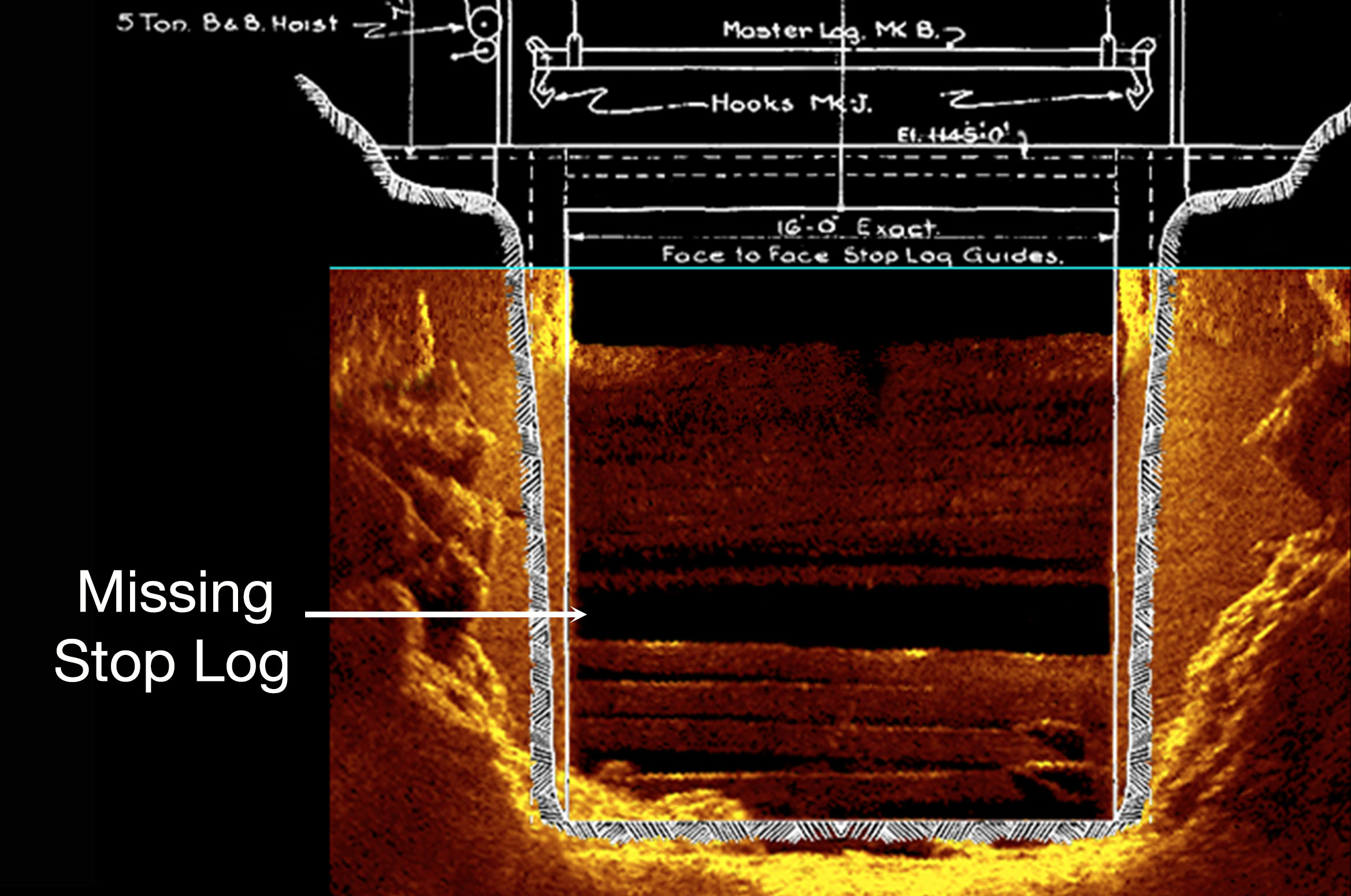
2D Imaging
Sonar imaging is ideal for low visibility or high flow situations where the acquisition of an image is a requirement. Dominion Divers conducts surveys with the latest technology offered by Kongsberg Maritime. This technology is excellent for detailing major structural defects pertaining to various marine assets including bridges, wharfs, and water control structures.
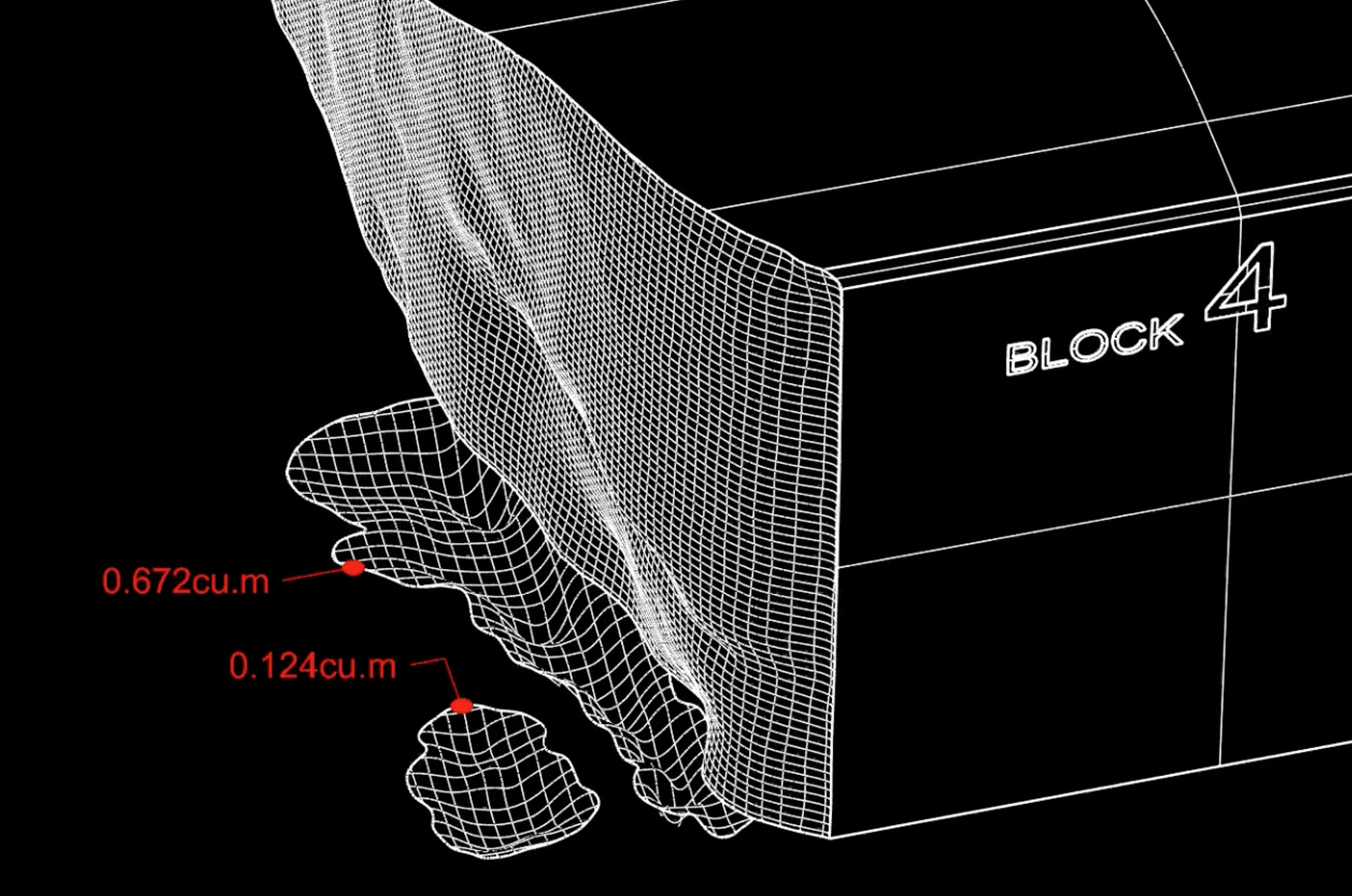
3D Point Cloud Data
The collection of point cloud data is vital when quantifying complex geometry where a typical measuring apparatus is not adequate. Using a focused beam to ascertain spatial data is ideal for mapping out complex structures. Our high-resolution profiling sonar can identify deficiencies to the structures and outline scouring around footings. Other applications include obtaining volumetric data to acquire a baseline for continuous monitoring or for future project planning.
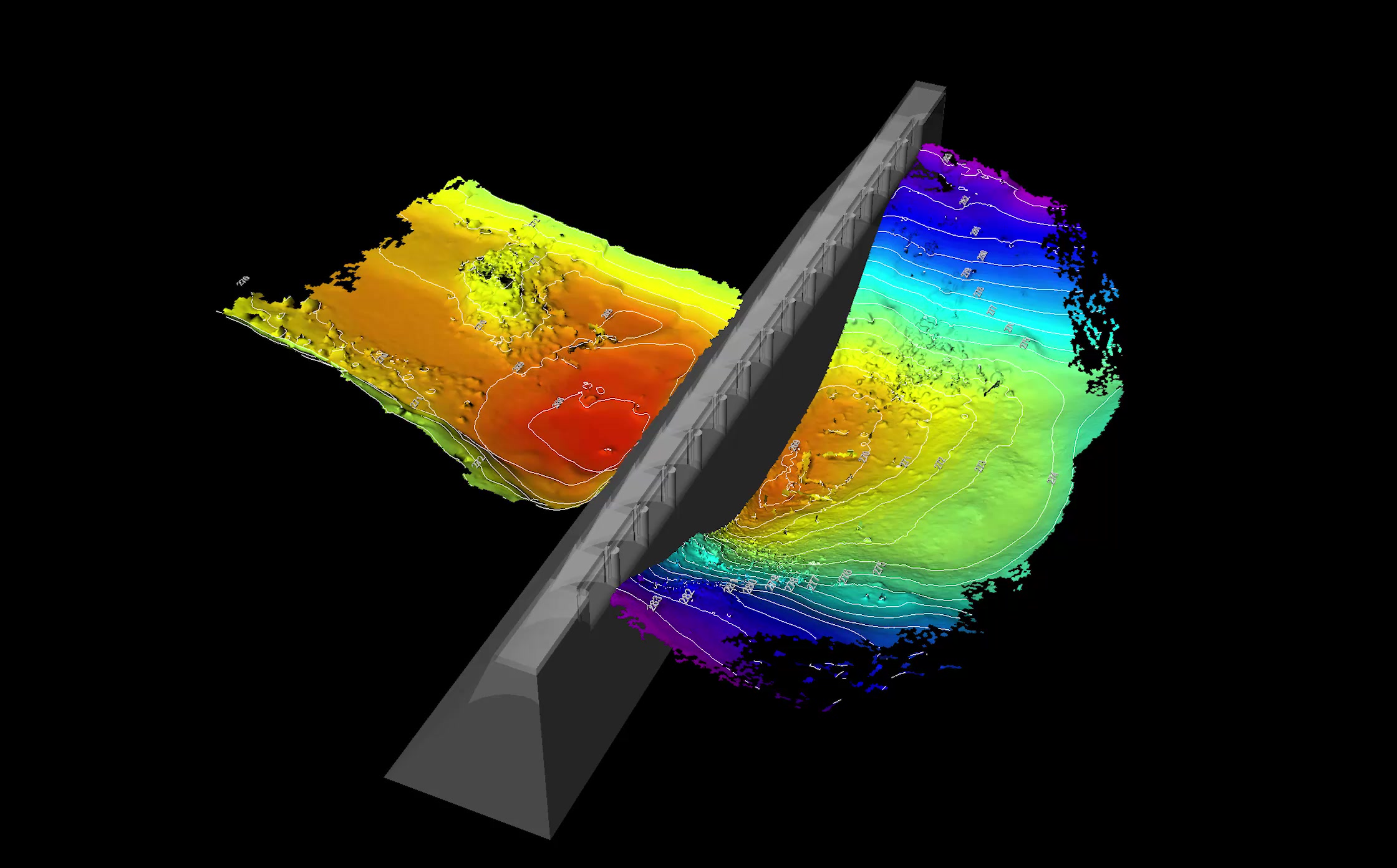
Bathymetry
Dominion Divers can compile high-resolution bathymetry data including the identification of minimal cross-sectional objects. Typical applications include search and recovery, bathymetry surveys, pipeline mapping, scour detection and protection levels.